Trail Access

Appropriate Trail Access = Trail User Safety
A trailhead is a designated public access point to a trail, often—but not always—located at its terminus points. The trailhead is typically a place where users begin or end their journeys and where they get oriented to the trail or trail network. On the Ecusta Trail, there will be a trailhead in downtown Hendersonville, one near the "halfway point", and a trailhead where the trail crosses the county line, once construction is complete. Until then, there are already other minor access points along the trail, such as road crossings and designated businesses, for users to gain entry. One sign to look for is the blue crossing sign that reads:
| REPORT EMERGENCY |
| OR PROBLEM |
| TO 1-866-386-9321 |
| CROSSING ###-###X |
Any road crossing with this blue sign is a permitted trail access point. Trail users should not enter the trail in areas where signs are not present, as there may be a safety concern.
Each new access point creates what's called a point of conflict, where traffic is moving in a perpendicular direction than those on the trail. This can create dangerous conditions, especially for children and pets. It's also important for Emergency Services to know where all access points are in the case on an emergency.
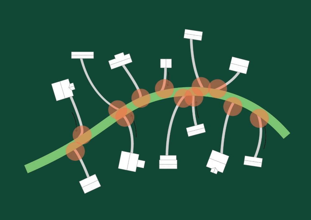
The visual below shows the importance of planning trail access. It depicts two scenarios: In the first, each structure/business has a dedicated entry that intersects with the main path. The second shows paths that share access with neighbors. Each intersection, circled in red, is a point of confict. This is especially relevant in scenarios like the Ecusta trail where we expect bike traffic. The greater the number of points of conflict, the more likely a collision will occur. It is easy to see that sharing and coordinating access is the safest approach for all trail-users.